

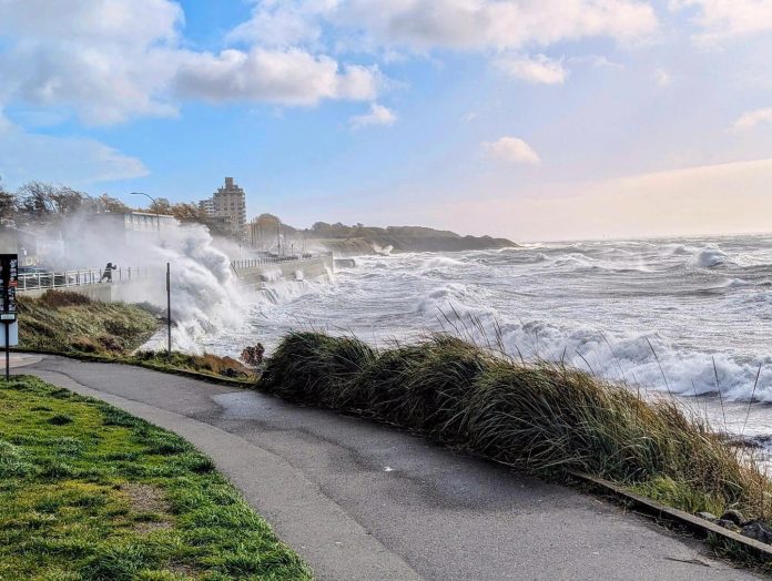
Greater Victoria and the Southern Gulf Islands are under a wind warning, with southeasterly gusts expected to reach 90 km/h early Saturday evening.
The winds are forecast to ease near midnight before gusty southwesterly winds continue overnight and into Sunday morning.
Environment Canada says local power outages are possible and advises residents to secure loose outdoor items.
Wind warnings are also in effect across much of Vancouver Island.
North Vancouver Island could see gusts up to 110 km/h Saturday morning before winds ease later in the day.
East Vancouver Island, from Nanoose Bay to Campbell River, could see gusts up to 90 km/h this afternoon and tonight. Inland Vancouver Island could see gusts up to 90 km/h late Saturday evening, while west Vancouver Island is forecast to see the strongest winds.
On west Vancouver Island, southeasterly winds gusting to 100 km/h are expected this afternoon and evening.
The winds are forecast to shift southwesterly late tonight, with gusts reaching 110 km/h into Sunday morning.
Environment Canada warns that power outages, property damage and injuries from flying or falling debris are possible.
Rainfall warnings are in effect for parts of the Island. East Vancouver Island, between Nanoose Bay and Fanny Bay, could receive about 50 mm of rain through Sunday morning.
Inland Vancouver Island could see 80 to 100 mm, with the highest amounts near Gold River. West Vancouver Island is forecast to receive 70 to 100 mm, with 100 to 120 mm possible around Zeballos and Tahsis.
A coastal flooding statement also covers exposed west coast shorelines from Cape Scott to Bamfield. Minor flooding is possible around high tide near noon Saturday and Sunday, as strong winds and large waves raise water levels. Roads and walkways could be affected by water and debris.
Environment Canada advises people to monitor changing conditions, watch for pooling water and avoid exposed shorelines during high tides.
💬 Join the conversation
No comments yet — be the first to start the conversation