")
What’s a week without a little wind on Vancouver Island?
Greater Victoria is set to start the week with strong gusty conditions, as Environment Canada has issued a special weather statement calling for winds up to 70 km/h beginning Monday afternoon.
The advisory, classified as minor, warns that a vigorous cold front will move across the south coast late Monday, bringing a burst of westerly winds in its wake.
According to Environment Canada, winds will begin to pick up around 4 p.m. on April 6th, with gusts reaching up to 70 km/h in exposed areas, particularly near the Juan de Fuca Strait.
The strongest winds are expected through the evening and overnight hours before easing Tuesday morning.
Residents are advised that these gusts could:
- Toss unsecured outdoor items
- Break small tree branches
- Lead to isolated power outages
- Cause minor travel disruptions
Despite the blustery start, the rest of the week is shaping up to be largely sunny across Greater Victoria.
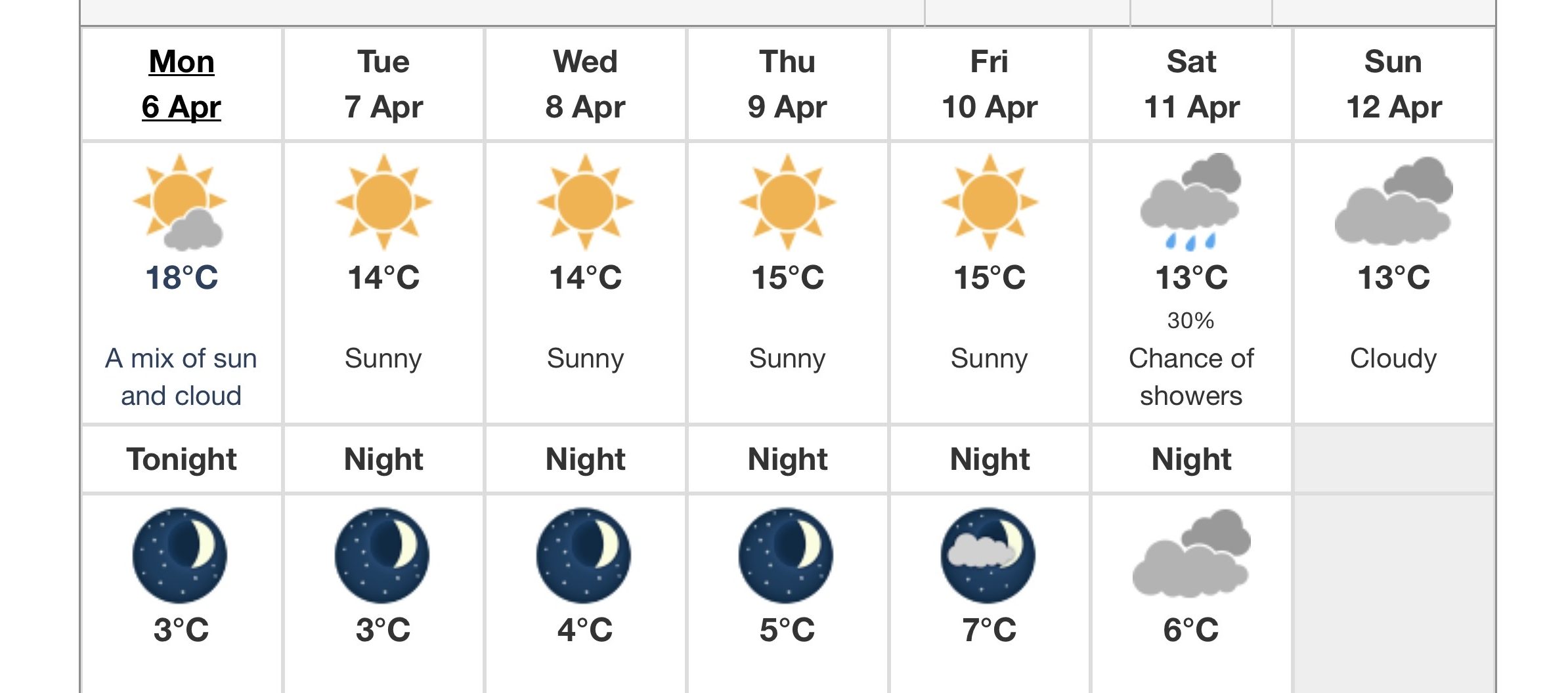
Monday will see a mix of sun and cloud with a high of 18°C, though it will feel cooler near the water. Winds will remain the main story into the evening, with temperatures dropping to around 3°C overnight.
Conditions calm down Tuesday, with sunshine and lighter winds expected and a high of 14°C. That trend continues through midweek, with clear skies and daytime highs in the mid-teens.
By the weekend, cloud cover and a chance of showers begin to creep back into the forecast.